
International comparative analysis of methods for modeling of micro pollutant emissions into surface waters in the light of increasing demands on result accuracy, reporting and planning of measures (Inn-project)
- contact:
M.Sc. Maria Kaiser
Dipl.-Geoökol. Lucas Reid - funding:
Federal Environment Agency Germany
- startdate:
11/2013
- enddate:
04/2017
Short description
The research project aims to further development the model system MoRE (Modelling of Regionalized Emissions), regarding a spatially and temporally resolved delineation of water, sediment and substance flow in river basins.
The previous developments of river basin models by environmental protection agencies for quantification of substance emission were merely focused on their own territory.
But river basins of border river systems are spread over two or more state territories, which often have very different characteristics of the natural environment and the distribution of land use. Though parts of foreign river basins were also examined to be able to estimate transboundary outflow and river loads, the spatial resolution and availability of data were considerably worse.
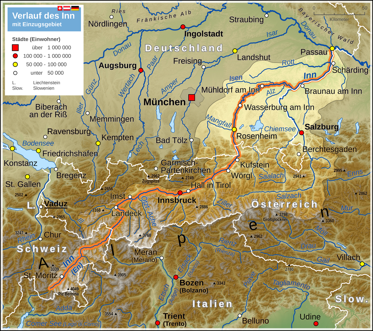
Hence, examinations on national basis for rivers like the Inn, which crosses borders several times during his course, are not appropriate. Essential control parameters of water and substance transport would be captured insufficiently and a realistic illustration of total emissions as basis for an efficiently planning of measures would be virtually impossible.
Coordinated research projects by
- Environment Agency Austria
- Bavarian Environment Agency and
- Germany Federal Environment Agency
in the river basin of the Inn are supposed to counteract this deficiency. The general objective of the cooperation partners is a coordinated examination of the Inn-Salzach catchment regarding the ascertainment of nutrient and pollutant input. The experience and results gathered this way can be used as foundation for examinations in the entire Danube area. Using a coordinated data base as well as coordinated and improved assessment models, a basis for a joint evaluation of all nutrient and pollutant inputs (from point and diffuse sources) for the entire Inn-Salzach catchment basin are to be established.
The long-term objective (from an economic and environmental point of view) is an efficient implementation of future planning steps in line with a transnational water management.
The following objectives are specified within this concept:
- Adjustment, validation and connection of the water balance model LARSIM-ME to the model system MoRE and development of a model compatible approach for urban water balance
- Deduction of a particulate matter balance for paved and unpaved areas in the river basin of the Inn
- Characterization of retention processes in catchment area and the river channel
- Connection of dissolved and particulate mass transport for nutrients and selected priority substances
- Validation of the model results for emission pathways on the basis of monitoring data